
Thank you for supporting this site ❤️
Make a donation
Make a donation
Gear up for your next adventure:
As an Amazon Associate, this site earns from qualifying purchases at no extra cost to you.
Lönshult topographic map
Click on the map to display elevation.
Thank you for supporting this site ❤️
Make a donation
Make a donation
Gear up for your next adventure:
As an Amazon Associate, this site earns from qualifying purchases at no extra cost to you.
About this map
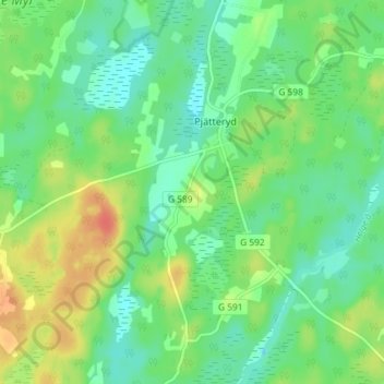
Name: Lönshult topographic map, elevation, terrain.
Location: Lönshult, Pjätteryd, Älmhults kommun, Kronoberg County, Sweden (56.61527 14.00176 56.65527 14.04176)
Average elevation: 142 m
Minimum elevation: 125 m
Maximum elevation: 171 m
Thank you for supporting this site ❤️
Make a donation
Make a donation
Gear up for your next adventure:
As an Amazon Associate, this site earns from qualifying purchases at no extra cost to you.