
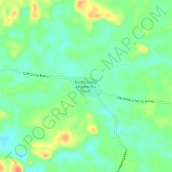
Benito Juárez Segundo (La Raya) topographic map
Interactive map
Click on the map to display elevation.
About this map
Name: Benito Juárez Segundo (La Raya) topographic map, elevation, terrain.
Location: Benito Juárez Segundo (La Raya), Uxpanapa, Veracruz, México (17.29639 -94.51861 17.33639 -94.47861)
Average elevation: 87 m
Minimum elevation: 67 m
Maximum elevation: 124 m
Other topographic maps
Click on a map to view its topography, its elevation and its terrain.
Poblado Cinco
Poblado Cinco, Uxpanapa, Veracruz, México
Average elevation: 97 m
La Chinantla
La Chinantla, Uxpanapa, Veracruz, México
Average elevation: 117 m
Isthmus of Tehuantepec
Isthmus of Tehuantepec, Uxpanapa, Veracruz, México
Average elevation: 277 m