
Thank you for supporting this site ❤️
Make a donation
Make a donation
Gear up for your next adventure:
As an Amazon Associate, this site earns from qualifying purchases at no extra cost to you.
Wahkhen topographic map
Click on the map to display elevation.
Thank you for supporting this site ❤️
Make a donation
Make a donation
Gear up for your next adventure:
As an Amazon Associate, this site earns from qualifying purchases at no extra cost to you.
About this map
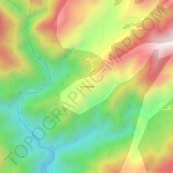
Name: Wahkhen topographic map, elevation, terrain.
Location: Wahkhen, Pynursla, East Khasi Hills, Meghalaya, 793110, India (25.32674 91.83020 25.36674 91.87020)
Average elevation: 818 m
Minimum elevation: 324 m
Maximum elevation: 1,438 m
Thank you for supporting this site ❤️
Make a donation
Make a donation
Gear up for your next adventure:
As an Amazon Associate, this site earns from qualifying purchases at no extra cost to you.