
Thank you for supporting this site ❤️
Make a donation
Make a donation
Gear up for your next adventure:
As an Amazon Associate, this site earns from qualifying purchases at no extra cost to you.
Hannafore topographic map
Click on the map to display elevation.
Thank you for supporting this site ❤️
Make a donation
Make a donation
Gear up for your next adventure:
As an Amazon Associate, this site earns from qualifying purchases at no extra cost to you.
About this map
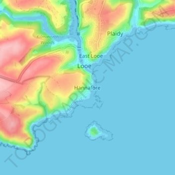
Name: Hannafore topographic map, elevation, terrain.
Location: Hannafore, Looe, Cornwall, England, PL13 2DW, United Kingdom (50.32726 -4.47312 50.36726 -4.43312)
Average elevation: 33 m
Minimum elevation: -1 m
Maximum elevation: 137 m
Thank you for supporting this site ❤️
Make a donation
Make a donation
Gear up for your next adventure:
As an Amazon Associate, this site earns from qualifying purchases at no extra cost to you.