
Thank you for supporting this site ❤️
Make a donation
Make a donation
Gear up for your next adventure:
As an Amazon Associate, this site earns from qualifying purchases at no extra cost to you.
Rebelhos topographic map
Click on the map to display elevation.
Thank you for supporting this site ❤️
Make a donation
Make a donation
Gear up for your next adventure:
As an Amazon Associate, this site earns from qualifying purchases at no extra cost to you.
About this map
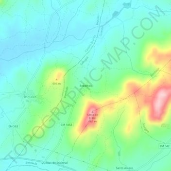
Name: Rebelhos topographic map, elevation, terrain.
Location: Rebelhos, Bendada, Sabugal, Guarda, 6250-191, Portugal (40.30813 -7.29926 40.34813 -7.25926)
Average elevation: 513 m
Minimum elevation: 456 m
Maximum elevation: 671 m
Thank you for supporting this site ❤️
Make a donation
Make a donation
Gear up for your next adventure:
As an Amazon Associate, this site earns from qualifying purchases at no extra cost to you.