
Thank you for supporting this site ❤️
Make a donation
Make a donation
Gear up for your next adventure:
As an Amazon Associate, this site earns from qualifying purchases at no extra cost to you.
Isauld topographic map
Click on the map to display elevation.
Thank you for supporting this site ❤️
Make a donation
Make a donation
Gear up for your next adventure:
As an Amazon Associate, this site earns from qualifying purchases at no extra cost to you.
About this map
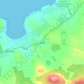
Name: Isauld topographic map, elevation, terrain.
Location: Isauld, Reay, Highland, Scotland, KW14 7RW, United Kingdom (58.54172 -3.78103 58.58172 -3.74103)
Average elevation: 30 m
Minimum elevation: 0 m
Maximum elevation: 119 m
Thank you for supporting this site ❤️
Make a donation
Make a donation
Gear up for your next adventure:
As an Amazon Associate, this site earns from qualifying purchases at no extra cost to you.