

Velbert topographic map
Click on the map to display elevation.
Velbert
Velbert stands on the highest part of the Niederberg region and also in its centre. Its average elevation is around 230 metres above sea level; its highest point, at 303 metres, is the Hordt-Berg, and its lowest, at around 70.6 metres, is in Nierenhof am Deilbach. The highest point in Velbert itself is 263 metres above sea level, at the corner of Friedrichstraße and Langenberger Straße.
About this map
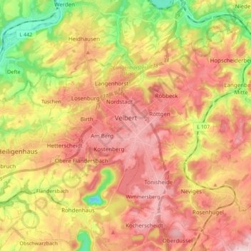
Name: Velbert topographic map, elevation, terrain.
Location: Velbert, Kreis Mettmann, North Rhine-Westphalia, Germany (51.29318 7.00131 51.38142 7.16978)
Average elevation: 172 m
Minimum elevation: 21 m
Maximum elevation: 292 m