Renmore topographic map
Interactive map
Click on the map to display elevation.
About this map
![Renmore topographic map, elevation, terrain](/pub/maps/relation/rtj/jl6vt6/thumbnail.jpg)
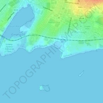
Name: Renmore topographic map, elevation, terrain.
Location: Renmore, Galway City, County Galway, Connacht, Ireland (53.25787 -9.03133 53.27893 -9.01334)
Average elevation: 6 m
Minimum elevation: -3 m
Maximum elevation: 40 m
Other topographic maps
Click on a map to view its topography, its elevation and its terrain.
![River Corrib topographic map, elevation, terrain](/pub/maps/way/ncm2/t7k4vf3/icon.jpg)
River Corrib
Ireland > Galway City > Galway City
River Corrib, Galway City, County Galway, Connacht, H91 E1NY, Ireland
Average elevation: 7 m
![Parkmore topographic map, elevation, terrain](/pub/maps/relation/3x1h/kzxl3l/icon.jpg)
Parkmore
Ireland > Galway City > Galway City
Parkmore, Ballybrit, Galway City, County Galway, Connacht, Ireland
Average elevation: 37 m
![Rahoon topographic map, elevation, terrain](/pub/maps/relation/s3f3/x4sbb3/icon.jpg)
Rahoon
Ireland > Galway City > Galway City
Rahoon, Galway City, County Galway, Connacht, Ireland
Average elevation: 42 m
![Wellpark topographic map, elevation, terrain](/pub/maps/relation/g5k/wmsczs/icon.jpg)
Wellpark
Ireland > Galway City > Galway City
Wellpark, Galway City, County Galway, Connacht, Ireland
Average elevation: 17 m