
Xingtan topographic map
Interactive map
Click on the map to display elevation.
About this map
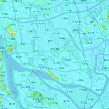
Name: Xingtan topographic map, elevation, terrain.
Location: Xingtan, Shunde District, Foshan, Guangdong Province, China (22.72115 113.05585 22.84552 113.23363)
Average elevation: 4 m
Minimum elevation: -4 m
Maximum elevation: 91 m