
Taiping District topographic map
Interactive map
Click on the map to display elevation.
About this map
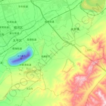
Name: Taiping District topographic map, elevation, terrain.
Location: Taiping District, Fuxin City, Liaoning, 123000, China (41.94356 121.64238 42.04325 121.80792)
Average elevation: 235 m
Minimum elevation: -137 m
Maximum elevation: 631 m
Other topographic maps
Click on a map to view its topography, its elevation and its terrain.
Shuangshu
China > Liaoning > Huludao City
Shuangshu, Huludao City, Liaoning, China
Average elevation: 44 m