

Logan topographic map
Click on the map to display elevation.
Logan
The city lies near the eastern edge of Cache Valley on the western slopes of the Bear River Mountains. Mount Logan rises to an elevation of 9,710 feet (2,960 m) immediately to the east, and south of Logan Canyon. The eastern portions of the city are constructed on top of shelf-like "benches", late Pleistocene sedimentary deposits created by the glacially fed Logan River feeding into the northern stretches of Lake Bonneville, building a "Gilbert-type" river delta over several thousand years. The Logan River later cut down through these sedimentary deposits following the draining of Lake Bonneville approximately 14,500 years ago. This created a low-lying area with very steep slopes that reach into the rest of town and to the Logan River bottomlands. To the west of Logan lie flatlands that contain both farmland and marshes. To the north and south of Logan are rapidly growing residential suburbs.
About this map
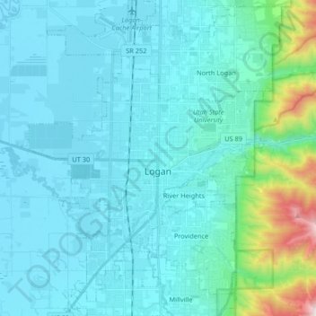
Name: Logan topographic map, elevation, terrain.
Location: Logan, Cache County, Utah, United States (41.67538 -111.90194 41.79736 -111.78019)
Average elevation: 1,498 m
Minimum elevation: 1,342 m
Maximum elevation: 2,659 m