Geolocate

Prodromos topographic map

Click on the map to display elevation.

About this map
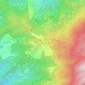
Name: Prodromos topographic map, elevation, terrain.

Location: Prodromos, Limassol District, Cyprus, 2850, Cyprus (34.92995 32.81249 34.96995 32.85249)

Average elevation: 1,311 m

Minimum elevation: 868 m

Maximum elevation: 1,910 m

Gear up for your next adventure:

📍Handheld GPS Devices - Accurate GPS units for mapping and navigation
🧥Waterproof Hiking Jackets - Rain jackets for unpredictable weather
🎁Outdoor Gift Ideas - Great gifts for adventurers
🛶Waterproof Dry Bags - Keep electronics and clothes dry during wet treks
🧦Hiking Socks - Comfortable socks to prevent blisters

As an Amazon Associate, this site earns from qualifying purchases at no extra cost to you.