
Agoura Hills topographic map
Interactive map
Click on the map to display elevation.
About this map
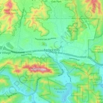
Name: Agoura Hills topographic map, elevation, terrain.
Average elevation: 333 m
Minimum elevation: 225 m
Maximum elevation: 602 m
Agoura Hills has a mountain called Ballard Mountain named after pioneer settler and freed slave John Ballard. The name of the mountain was officially changed from Negrohead to Ballard in a ceremony on February 20, 2010. Ladyface Mountain is another prominent mountain on the west side of the Conejo Valley and stands at an elevation of 2,031 feet (619 m).
Other topographic maps
Click on a map to view its topography, its elevation and its terrain.
Beverly Hills
United States > California > Los Angeles County
Beverly Hills, Los Angeles County, California, United States
Average elevation: 144 m
Arcadia
United States > California > Los Angeles County
Arcadia, Los Angeles County, CAL Fire Contract Counties, California, United States
Average elevation: 184 m
Los Angeles
United States > California > Los Angeles County
Los Angeles, Los Angeles County, California, United States
Average elevation: 241 m