
Make a donation
Gear up for your next adventure:
As an Amazon Associate, this site earns from qualifying purchases at no extra cost to you.
Les Rues d'à Bas topographic map
Click on the map to display elevation.
Make a donation
Gear up for your next adventure:
As an Amazon Associate, this site earns from qualifying purchases at no extra cost to you.
About this map
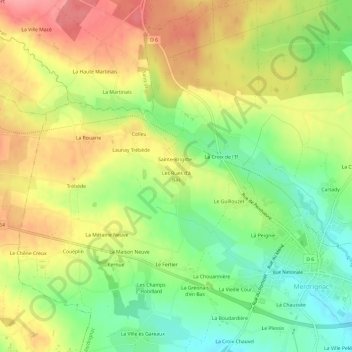
Name: Les Rues d'à Bas topographic map, elevation, terrain.
Average elevation: 165 m
Minimum elevation: 121 m
Maximum elevation: 210 m
Make a donation
Gear up for your next adventure:
As an Amazon Associate, this site earns from qualifying purchases at no extra cost to you.
Other topographic maps
Click on a map to view its topography, its elevation and its terrain.
Merdrignac
France > Bretagne > Côtes-d'Armor > Merdrignac
Merdrignac est située au cœur du plateau de Rohan (appellation discutable car la topographie est marquée par des collines désordonnées où ne se discerne aucune direction nette, et non par une surface plane), topographie en pente vers le sud. Ce plateau de Rohan qui s'étend de la baie de Douarnenez à la…
Average elevation: 146 m