
Thank you for supporting this site ❤️
Make a donation
Make a donation
Gear up for your next adventure:
As an Amazon Associate, this site earns from qualifying purchases at no extra cost to you.
Azmoos topographic map
Click on the map to display elevation.
Thank you for supporting this site ❤️
Make a donation
Make a donation
Gear up for your next adventure:
As an Amazon Associate, this site earns from qualifying purchases at no extra cost to you.
About this map
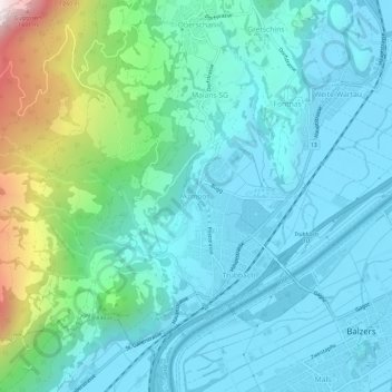
Name: Azmoos topographic map, elevation, terrain.
Location: Azmoos, Wartau, Wahlkreis Werdenberg, San Gallo, 9478, Svizzera (47.06089 9.45549 47.10089 9.49549)
Average elevation: 674 m
Minimum elevation: 465 m
Maximum elevation: 1,549 m
Thank you for supporting this site ❤️
Make a donation
Make a donation
Gear up for your next adventure:
As an Amazon Associate, this site earns from qualifying purchases at no extra cost to you.