
Cumberland County topographic map
Interactive map
Click on the map to display elevation.
About this map
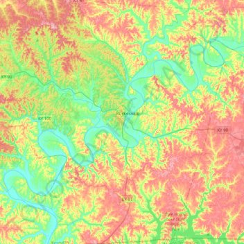
Name: Cumberland County topographic map, elevation, terrain.
Location: Cumberland County, Kentucky, United States of America (36.61853 -85.60121 36.93842 -85.21472)
Average elevation: 237 m
Minimum elevation: 157 m
Maximum elevation: 344 m
Other topographic maps
Click on a map to view its topography, its elevation and its terrain.
Powell County
United States of America > Kentucky
Powell County, Kentucky, United States of America
Average elevation: 293 m
Williamstown
United States of America > Kentucky > Williamstown
Williamstown, Grant County, Kentucky, 41097, United States of America
Average elevation: 262 m
Edmonson County
United States of America > Kentucky
Edmonson County, Kentucky, United States of America
Average elevation: 196 m
Green County
United States of America > Kentucky
Green County, Kentucky, United States of America
Average elevation: 230 m