
Thank you for supporting this site ❤️
Make a donation
Make a donation
Gear up for your next adventure:
As an Amazon Associate, this site earns from qualifying purchases at no extra cost to you.
Cellio topographic map
Click on the map to display elevation.
Thank you for supporting this site ❤️
Make a donation
Make a donation
Gear up for your next adventure:
As an Amazon Associate, this site earns from qualifying purchases at no extra cost to you.
About this map
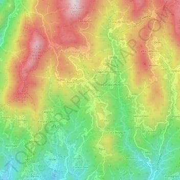
Name: Cellio topographic map, elevation, terrain.
Location: Cellio, Cellio con Breia, Vercelli, Piedmont, 13024, Italy (45.73607 8.29162 45.77607 8.33162)
Average elevation: 691 m
Minimum elevation: 402 m
Maximum elevation: 1,004 m
Thank you for supporting this site ❤️
Make a donation
Make a donation
Gear up for your next adventure:
As an Amazon Associate, this site earns from qualifying purchases at no extra cost to you.