
Gilliam County topographic map
Interactive map
Click on the map to display elevation.
About this map
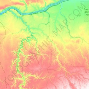
Name: Gilliam County topographic map, elevation, terrain.
Location: Gilliam County, Oregón, Estados Unidos de América (45.06516 -120.65357 45.81348 -119.75769)
Average elevation: 548 m
Minimum elevation: 47 m
Maximum elevation: 1,367 m
Other topographic maps
Click on a map to view its topography, its elevation and its terrain.
Arlington
Estados Unidos de América > Oregón > Gilliam County > Arlington
Arlington, Gilliam County, Oregón, Estados Unidos de América
Average elevation: 146 m