
Radley topographic map
Click on the map to display elevation.
About this map
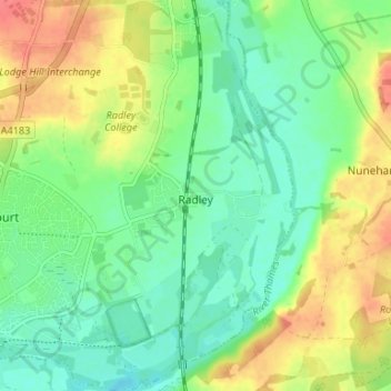
Name: Radley topographic map, elevation, terrain.
Average elevation: 66 m
Minimum elevation: 44 m
Maximum elevation: 100 m
Other topographic maps
Click on a map to view its topography, its elevation and its terrain.
Sutton Pools
United Kingdom > England > Oxfordshire > Vale of White Horse > Abingdon > Sutton Courtenay
Average elevation: 54 m
Sutton Wick
United Kingdom > England > Oxfordshire > Vale of White Horse > Abingdon > Drayton
Average elevation: 57 m