

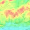
Palmyra topographic map
Click on the map to display elevation.
About this map

Name: Palmyra topographic map, elevation, terrain.
Location: Palmyra, Lebanon County, Pennsylvania, United States (40.29561 -76.61113 40.32279 -76.57232)
Average elevation: 140 m
Minimum elevation: 48 m
Maximum elevation: 184 m
Other topographic maps
Click on a map to view its topography, its elevation and its terrain.
Sunset
United States > Pennsylvania > Lebanon County > North Lebanon Township
Average elevation: 180 m

Colebrook
United States > Pennsylvania > Lebanon County > South Londonderry Township
Average elevation: 189 m

Blue Mountain
United States > Pennsylvania > Lebanon County > East Hanover Township
The ridge of Blue Mountain runs for 150 miles (240 km) through Pennsylvania, reaching an elevation of 2,270 feet (690 m) above sea level just north of the Pennsylvania Turnpike, near the borough of Newburg. Most of the ridgecrest, however, only reaches between 1,400 and 1,700 feet (430 and 520 m) in elevation.…
Average elevation: 220 m

Fort Indiantown Gap
United States > Pennsylvania > Lebanon County > Union Township
Average elevation: 217 m

Lights Dam
United States > Pennsylvania > Lebanon County > North Lebanon Township > Ebenezer
Average elevation: 168 m

Woodfort
United States > Pennsylvania > Lebanon County > North Cornwall Township
Average elevation: 144 m

Cambelltown Community Park
United States > Pennsylvania > Lebanon County > South Londonderry Township > Campbelltown > Plainville
Average elevation: 151 m
Lights Dam
United States > Pennsylvania > Lebanon County > North Lebanon Township > Ebenezer
Average elevation: 168 m