
Thank you for supporting this site ❤️
Make a donation
Make a donation
Gear up for your next adventure:
As an Amazon Associate, this site earns from qualifying purchases at no extra cost to you.
Yesa topographic map
Click on the map to display elevation.
Thank you for supporting this site ❤️
Make a donation
Make a donation
Gear up for your next adventure:
As an Amazon Associate, this site earns from qualifying purchases at no extra cost to you.
About this map
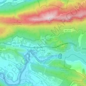
Name: Yesa topographic map, elevation, terrain.
Location: Yesa, Zangozerria / Comarca de Sangüesa, Navarre, Spain (42.60313 -1.24350 42.64851 -1.15382)
Average elevation: 690 m
Minimum elevation: 408 m
Maximum elevation: 1,346 m
Thank you for supporting this site ❤️
Make a donation
Make a donation
Gear up for your next adventure:
As an Amazon Associate, this site earns from qualifying purchases at no extra cost to you.