
Thank you for supporting this site ❤️
Make a donation
Make a donation
Gear up for your next adventure:
As an Amazon Associate, this site earns from qualifying purchases at no extra cost to you.
Paltarumi topographic map
Click on the map to display elevation.
Thank you for supporting this site ❤️
Make a donation
Make a donation
Gear up for your next adventure:
As an Amazon Associate, this site earns from qualifying purchases at no extra cost to you.
About this map
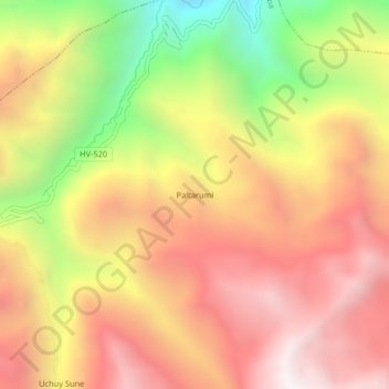
Name: Paltarumi topographic map, elevation, terrain.
Location: Paltarumi, Cochabamba, Tayacaja, Huancavelica, Perú (-12.23866 -74.58146 -12.19866 -74.54146)
Average elevation: 3,691 m
Minimum elevation: 2,826 m
Maximum elevation: 4,315 m
Thank you for supporting this site ❤️
Make a donation
Make a donation
Gear up for your next adventure:
As an Amazon Associate, this site earns from qualifying purchases at no extra cost to you.