Geolocate

Robotyne topographic map

Click on the map to display elevation.

About this map
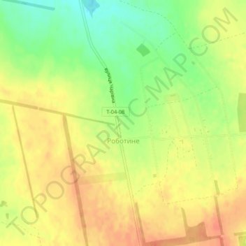
Name: Robotyne topographic map, elevation, terrain.

Location: Robotyne, Tokmatska urban hromada, Polohy Raion, Zaporizhia Oblast, 71720, Ukraine (47.43679 35.82155 47.45712 35.84516)

Average elevation: 138 m

Minimum elevation: 113 m

Maximum elevation: 157 m

Other topographic maps

Click on a map to view its topography, its elevation and its terrain.

Zaporizhzhia

Ukraine > Zaporizhia Oblast

Zaporizhzhia is located in south-eastern Ukraine. The Dnieper splits the city in two; between them is Khortytsia Island. The city covers 334 km2 (129 sq mi) at an elevation of 50 m (160 ft) above sea level. The New and Old Dnieper flow past around Khortytsia: The New Dnieper [uk] is about 800 m (2,600 feet)…

Average elevation: 78 m

Tokmak

Ukraine > Zaporizhia Oblast

Average elevation: 64 m

Polohy

Ukraine > Zaporizhia Oblast

Average elevation: 137 m

Gear up for your next adventure:

🔨Multi-tool Devices - Versatile tools for gear repairs in the field
⛺Emergency Bivvy Bags - Life-saving heat-reflective shelter for emergencies
🧭Hiking Compasses - Reliable compasses for navigation off‑trail
🔥Camping Stoves - Portable camping stoves for outdoor cooking
🔦High-Lumen Headlamps - Hands-free lighting for early starts or late finishes

As an Amazon Associate, this site earns from qualifying purchases at no extra cost to you.