
Plamondon topographic map
Interactive map
Click on the map to display elevation.
About this map
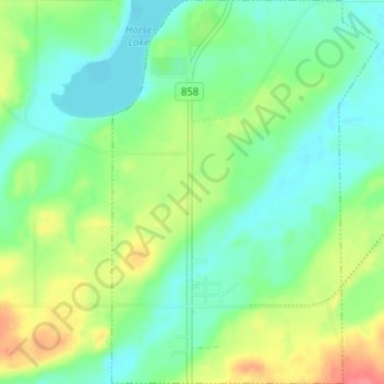
Name: Plamondon topographic map, elevation, terrain.
Location: Plamondon, Division No. 12, Alberta, T0A 2T0, Canada (54.84186 -112.35730 54.87828 -112.31327)
Average elevation: 562 m
Minimum elevation: 541 m
Maximum elevation: 602 m
Other topographic maps
Click on a map to view its topography, its elevation and its terrain.
McRae
Canada > Alberta > Division No. 12
McRae, Division No. 12, Alberta, Canada
Average elevation: 621 m
City of Cold Lake
Canada > Alberta > Division No. 12
City of Cold Lake, Division No. 12, Alberta, Canada
Average elevation: 542 m