
Cross County topographic map
Interactive map
Click on the map to display elevation.
About this map
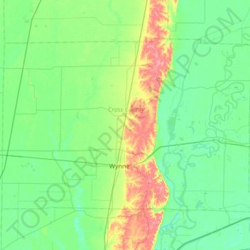
Name: Cross County topographic map, elevation, terrain.
Location: Cross County, Arkansas, United States of America (35.14302 -91.04253 35.45059 -90.49977)
Average elevation: 73 m
Minimum elevation: 53 m
Maximum elevation: 140 m
Other topographic maps
Click on a map to view its topography, its elevation and its terrain.