
Lower Lough MacNean topographic map
Interactive map
Click on the map to display elevation.
About this map
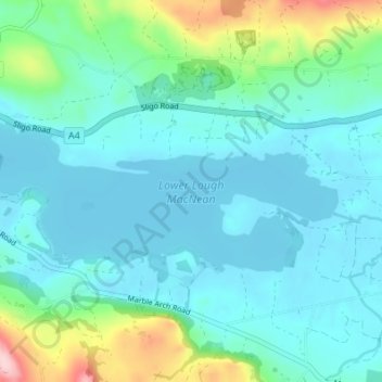
Name: Lower Lough MacNean topographic map, elevation, terrain.
Average elevation: 86 m
Minimum elevation: 47 m
Maximum elevation: 260 m
Other topographic maps
Click on a map to view its topography, its elevation and its terrain.
Upper Lough MacNean
United Kingdom > Northern Ireland > Belcoo
Upper Lough MacNean, Lattone Road, Corralea, Belcoo, County Fermanagh, Northern Ireland, BT93 5FB, United Kingdom
Average elevation: 89 m