
Thank you for supporting this site ❤️
Make a donation
Make a donation
Gear up for your next adventure:
As an Amazon Associate, this site earns from qualifying purchases at no extra cost to you.
McHenry topographic map
Click on the map to display elevation.
Thank you for supporting this site ❤️
Make a donation
Make a donation
Gear up for your next adventure:
As an Amazon Associate, this site earns from qualifying purchases at no extra cost to you.
About this map
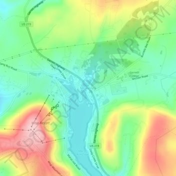
Name: McHenry topographic map, elevation, terrain.
Location: McHenry, Garrett County, Maryland, 21541, United States (39.53842 -79.37282 39.57842 -79.33282)
Average elevation: 817 m
Minimum elevation: 738 m
Maximum elevation: 943 m
Thank you for supporting this site ❤️
Make a donation
Make a donation
Gear up for your next adventure:
As an Amazon Associate, this site earns from qualifying purchases at no extra cost to you.