Geolocate

Rotherwick topographic map

Click on the map to display elevation.

About this map
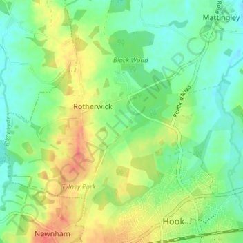
Name: Rotherwick topographic map, elevation, terrain.

Location: Rotherwick, Hart, Hampshire, England, United Kingdom (51.28369 -1.00230 51.31411 -0.94070)

Average elevation: 74 m

Minimum elevation: 54 m

Maximum elevation: 103 m

Gear up for your next adventure:

🌲Bushcraft Skills Books - Learn navigation, fire-making, and shelter building
🩻Outdoor Health Essentials - Necessary health items for hikes
🛰️Handheld GPS Units - Professional satellite navigation for Irish highlands
🔪Multi‑Tools & Knives - Versatile tools for outdoor tasks
🖊️All-Weather Pens - Pressurized ink cartridges that write upside down and in wet

As an Amazon Associate, this site earns from qualifying purchases at no extra cost to you.