Geolocate

Stithians topographic map

Click on the map to display elevation.

About this map
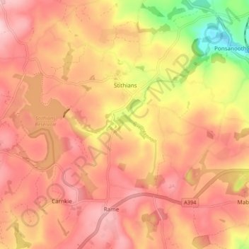
Name: Stithians topographic map, elevation, terrain.

Location: Stithians, Cornwall, England, United Kingdom (50.15456 -5.22841 50.20692 -5.14583)

Average elevation: 151 m

Minimum elevation: 24 m

Maximum elevation: 217 m

Gear up for your next adventure:

🩹Compact First Aid Kits - Treat blisters and minor injuries on the trail
🌂Windproof Trekking Umbrellas - Protection during vertical Irish rain
🧯Campfire Safety Gear - Gear to safely manage fires
🎧Wireless Earbuds - Music on the move
📟Handheld Altimeters - Track elevation changes and weather patterns accurately

As an Amazon Associate, this site earns from qualifying purchases at no extra cost to you.