Geolocate

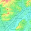
Nottingham Canal topographic map

Click on the map to display elevation.

About this map

Name: Nottingham Canal topographic map, elevation, terrain.

Location: Nottingham Canal, Cossall Marsh, Broxtowe, Nottinghamshire, England, NG16 2RU, United Kingdom (52.98218 -1.28875 52.98250 -1.28855)

Average elevation: 68 m

Minimum elevation: 43 m

Maximum elevation: 127 m

Other topographic maps

Click on a map to view its topography, its elevation and its terrain.

Beeston

United Kingdom > England > Nottinghamshire > Broxtowe

Average elevation: 39 m

Trowell

United Kingdom > England > Nottinghamshire > Broxtowe

Average elevation: 62 m

Nuthall

United Kingdom > England > Nottinghamshire > Broxtowe

Average elevation: 95 m

Moorgreen

United Kingdom > England > Nottinghamshire > Broxtowe

Average elevation: 105 m

Kimberley

United Kingdom > England > Nottinghamshire > Broxtowe

Average elevation: 104 m

Strelley

United Kingdom > England > Nottinghamshire > Broxtowe > Strelley

Average elevation: 100 m

Cossall

United Kingdom > England > Nottinghamshire > Broxtowe

Average elevation: 70 m

Awsworth

United Kingdom > England > Nottinghamshire > Broxtowe

Average elevation: 76 m

Beeston

United Kingdom > England > Nottinghamshire > Broxtowe

Average elevation: 44 m

Brinsley

United Kingdom > England > Nottinghamshire > Broxtowe

Average elevation: 100 m

Bramcote

United Kingdom > England > Nottinghamshire > Broxtowe

Average elevation: 55 m

Greasley

United Kingdom > England > Nottinghamshire > Broxtowe

Average elevation: 104 m

Stapleford

United Kingdom > England > Nottinghamshire > Broxtowe

Average elevation: 54 m

Awsworth

United Kingdom > England > Nottinghamshire > Broxtowe

Average elevation: 76 m

Beeston

United Kingdom > England > Nottinghamshire > Broxtowe

Average elevation: 39 m

Stapleford

United Kingdom > England > Nottinghamshire > Broxtowe

Average elevation: 54 m

Eastwood

United Kingdom > England > Nottinghamshire > Broxtowe

Average elevation: 81 m

Gear up for your next adventure:

🔌Travel Adapters - Essential for visitors to charge gear in Ireland
🖊️All-Weather Pens - Pressurized ink cartridges that write upside down and in wet
☕Vacuum Insulated Flasks - Keep tea or coffee hot for 12 hours on the summit
⌚Solar Multisport Watches - Advanced mapping and GPS tracking for endurance hikers
💧Portable Water Filters - Safe drinking water from streams and lakes

As an Amazon Associate, this site earns from qualifying purchases at no extra cost to you.