Geolocate

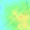
Yilkari topographic map

Click on the map to display elevation.

About this map

Name: Yilkari topographic map, elevation, terrain.

Location: Yilkari, Kalgoorlie, Western Australia, Australia (-30.85520 121.37473 -30.77784 121.50588)

Average elevation: 359 m

Minimum elevation: 170 m

Maximum elevation: 418 m

Other topographic maps

Click on a map to view its topography, its elevation and its terrain.

Trafalgar

Australia > Western Australia > Kalgoorlie

Average elevation: 353 m

Trafalgar

Australia > Western Australia > Kalgoorlie

Average elevation: 353 m

Purple Hill

Australia > Western Australia > Kalgoorlie

Average elevation: 392 m

Gear up for your next adventure:

🎒Hiking Backpacks - Durable backpacks for day hikes and multi‑day treks
📱Phone Holders for Biking - Secure phone mounts for touring cyclists
🎒Day Packs - Perfect packs for day trips
🚰Hydration Packs - Hands‑free water storage for hikers
🧤Touchscreen Glove Liners - Use your mapping app without freezing your hands

As an Amazon Associate, this site earns from qualifying purchases at no extra cost to you.