Geolocate

Farningham topographic map

Click on the map to display elevation.

About this map
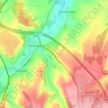
Name: Farningham topographic map, elevation, terrain.

Location: Farningham, Sevenoaks, Kent, England, United Kingdom (51.35143 0.19052 51.39803 0.25605)

Average elevation: 89 m

Minimum elevation: 16 m

Maximum elevation: 159 m

Gear up for your next adventure:

🧺Quick-Dry Hiking Towels - Space-saving towels for wild swimming or camping
🎒Fully Waterproof Rucksacks - Submersible protection for river crossings
🗺️Topographic Maps - Detailed maps for hiking, cycling and planning routes
📍Handheld GPS Devices - Accurate GPS units for mapping and navigation
🛍️Outdoor Accessory Kits - Bundles for new hikers

As an Amazon Associate, this site earns from qualifying purchases at no extra cost to you.