Geolocate

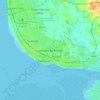
Staining topographic map

Click on the map to display elevation.

About this map

Name: Staining topographic map, elevation, terrain.

Location: Staining, Borough of Fylde, Lancashire, England, United Kingdom (53.80677 -3.01167 53.83101 -2.95195)

Average elevation: 13 m

Minimum elevation: -2 m

Maximum elevation: 28 m

Other topographic maps

Click on a map to view its topography, its elevation and its terrain.
Weeton

United Kingdom > England > Lancashire > Borough of Fylde

Average elevation: 22 m

Clifton

United Kingdom > England > Lancashire > Borough of Fylde

Average elevation: 14 m

Warton

United Kingdom > England > Lancashire > Borough of Fylde

Average elevation: 12 m

Gear up for your next adventure:

🔋Solar Power Banks - Keep your GPS and phone charged in the Irish wilderness
🍁Eco‑Friendly Outdoor Products - Sustainable outdoor gear
🧥Gore-Tex Rain Jackets - Breathable and fully waterproof shells for Irish weather
🎒Fully Waterproof Rucksacks - Submersible protection for river crossings
👣Orthopedic Boot Insoles - Extra comfort for long distance walking

As an Amazon Associate, this site earns from qualifying purchases at no extra cost to you.