
Thank you for supporting this site ❤️
Make a donation
Make a donation
Gear up for your next adventure:
As an Amazon Associate, this site earns from qualifying purchases at no extra cost to you.
Berglen topographic map
Click on the map to display elevation.
Thank you for supporting this site ❤️
Make a donation
Make a donation
Gear up for your next adventure:
As an Amazon Associate, this site earns from qualifying purchases at no extra cost to you.
About this map
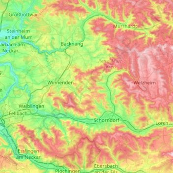
Name: Berglen topographic map, elevation, terrain.
Location: Berglen, Rems-Murr-Kreis, Baden-Württemberg, 73663, Germany (48.70770 9.31084 49.02770 9.63084)
Average elevation: 360 m
Minimum elevation: 192 m
Maximum elevation: 607 m
Thank you for supporting this site ❤️
Make a donation
Make a donation
Gear up for your next adventure:
As an Amazon Associate, this site earns from qualifying purchases at no extra cost to you.