
Banda Aceh topographic map
Interactive map
Click on the map to display elevation.
About this map
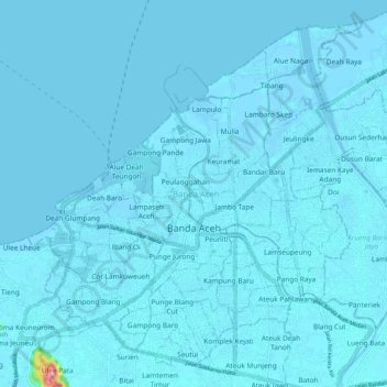
Name: Banda Aceh topographic map, elevation, terrain.
Location: Banda Aceh, Aceh, Sumatra, Indonesia (5.51639 95.27506 5.60724 95.37777)
Average elevation: 5 m
Minimum elevation: -3 m
Maximum elevation: 220 m
Banda Aceh (Acehnese: Banda Acèh, Jawoë: بند اچيه) is the capital and largest city in the province of Aceh, Indonesia. It is located on the island of Sumatra and has an elevation of 35 meters (115 feet). The city covers an area of 61.36 square kilometers (23.69 sq mi) and had a population of 223,446 people at the 2010 Census, rising to 252,899 at the 2020 Census. The official estimate as at mid 2023 was 261,969 (comprising 131,651 males and 130,318 females).
Other topographic maps
Click on a map to view its topography, its elevation and its terrain.
Meureubo
Indonesia > Aceh > Aceh Barat
Meureubo, Aceh Barat, Aceh, 23615, Indonesia
Average elevation: 9 m
Gunung Babahrot
Gunung Babahrot, Babah Rot, Aceh Barat Daya, Aceh, Indonesia
Average elevation: 157 m
Gunung Bandahara
Gunung Bandahara, Putri Betung, Gayo Lues, Aceh, Indonesia
Average elevation: 2,634 m
Gunung Mugajah
Gunung Mugajah, Serbajadi, Aceh Timur, Aceh, Indonesia
Average elevation: 2,189 m