
Douglasville topographic map
Interactive map
Click on the map to display elevation.
Douglasville
Located along a natural rise in the topography, Douglasville was originally known as "Skint Chestnut." The name was derived from a large tree used by Native Americans as a landmark; it was stripped of its bark so as to be more conspicuous.
About this map
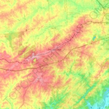
Name: Douglasville topographic map, elevation, terrain.
Location: Douglasville, Douglas County, Georgia, United States (33.69597 -84.79482 33.79098 -84.58940)
Average elevation: 310 m
Minimum elevation: 218 m
Maximum elevation: 389 m