
Ferry topographic map
Interactive map
Click on the map to display elevation.
About this map
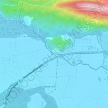
Name: Ferry topographic map, elevation, terrain.
Location: Ferry, Portmore, Saint Catherine, Middlesex County, Jamaica (18.00528 -76.89570 18.04528 -76.85570)
Average elevation: 44 m
Minimum elevation: 1 m
Maximum elevation: 358 m
Other topographic maps
Click on a map to view its topography, its elevation and its terrain.
Port Henderson
Jamaica > Saint Catherine > Portmore
Port Henderson, Portmore, Saint Catherine, Middlesex County, Jamaica
Average elevation: 24 m