
Gravina Island topographic map
Interactive map
Click on the map to display elevation.
About this map
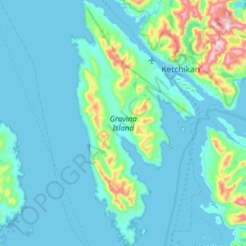
Name: Gravina Island topographic map, elevation, terrain.
Location: Gravina Island, Ketchikan Gateway, Alaska, United States (55.12888 -131.88068 55.42617 -131.61464)
Average elevation: 109 m
Minimum elevation: -11 m
Maximum elevation: 1,029 m