
Eyam CP topographic map
Interactive map
Click on the map to display elevation.
About this map
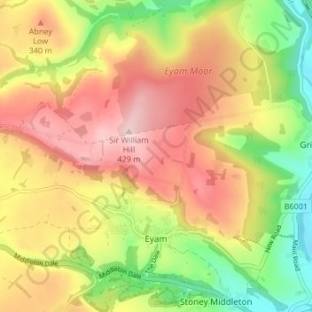
Name: Eyam CP topographic map, elevation, terrain.
Location: Eyam CP, Derbyshire Dales, Derbyshire, England, United Kingdom (53.27429 -1.71234 53.31441 -1.64686)
Average elevation: 280 m
Minimum elevation: 123 m
Maximum elevation: 427 m
Other topographic maps
Click on a map to view its topography, its elevation and its terrain.