
Make a donation
Gear up for your next adventure:
As an Amazon Associate, this site earns from qualifying purchases at no extra cost to you.
Churchover CP topographic map
Click on the map to display elevation.
Make a donation
Gear up for your next adventure:
As an Amazon Associate, this site earns from qualifying purchases at no extra cost to you.
About this map
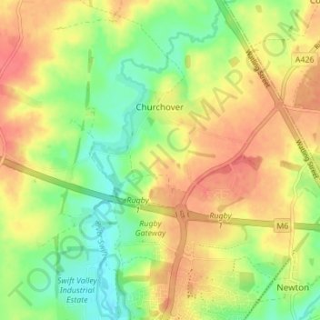
Name: Churchover CP topographic map, elevation, terrain.
Location: Churchover CP, Rugby, Warwickshire, England, United Kingdom (52.39430 -1.26540 52.43602 -1.21296)
Average elevation: 115 m
Minimum elevation: 87 m
Maximum elevation: 140 m
Make a donation
Gear up for your next adventure:
As an Amazon Associate, this site earns from qualifying purchases at no extra cost to you.
Other topographic maps
Click on a map to view its topography, its elevation and its terrain.
Make a donation
Gear up for your next adventure:
As an Amazon Associate, this site earns from qualifying purchases at no extra cost to you.
Brinklow Marina
United Kingdom > England > Warwickshire > Rugby > King's Newnham CP
Average elevation: 95 m
Make a donation
Gear up for your next adventure:
As an Amazon Associate, this site earns from qualifying purchases at no extra cost to you.