Geolocate

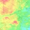
Batavia topographic map

Click on the map to display elevation.

About this map

Name: Batavia topographic map, elevation, terrain.

Location: Batavia, Batavia Township, Kane County, Illinois, 60510, United States (41.81644 -88.36301 41.87126 -88.25972)

Average elevation: 224 m

Minimum elevation: 198 m

Maximum elevation: 272 m

Other topographic maps

Click on a map to view its topography, its elevation and its terrain.
Elgin

United States > Illinois > Kane County

Average elevation: 255 m

Elgin

United States > Illinois > Kane County

Average elevation: 255 m

Campton Township

United States > Illinois > Kane County

Average elevation: 267 m

Gear up for your next adventure:

🧤Thermal Gloves - Warm gloves for cold weather
🗾Ireland Map Books - Top map books for exploring Ireland
🧗Rock Climbing Gear - Essentials for the cliffs of Moher or Gap of Dunloe
🛶Inflatable Touring Kayaks - Explore Irish loughs and coastal topography
🩻Outdoor Health Essentials - Necessary health items for hikes

As an Amazon Associate, this site earns from qualifying purchases at no extra cost to you.