
Thank you for supporting this site ❤️
Make a donation
Make a donation
Gear up for your next adventure:
As an Amazon Associate, this site earns from qualifying purchases at no extra cost to you.
Bivio topographic map
Click on the map to display elevation.
Thank you for supporting this site ❤️
Make a donation
Make a donation
Gear up for your next adventure:
As an Amazon Associate, this site earns from qualifying purchases at no extra cost to you.
About this map
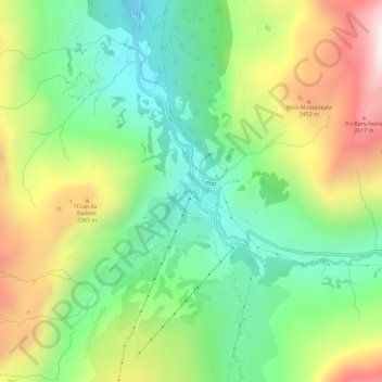
Name: Bivio topographic map, elevation, terrain.
Location: Bivio, Surses, Albula, Grigioni, 7457, Svizzera (46.44875 9.62969 46.48875 9.66969)
Average elevation: 2,085 m
Minimum elevation: 1,670 m
Maximum elevation: 2,754 m
Thank you for supporting this site ❤️
Make a donation
Make a donation
Gear up for your next adventure:
As an Amazon Associate, this site earns from qualifying purchases at no extra cost to you.