
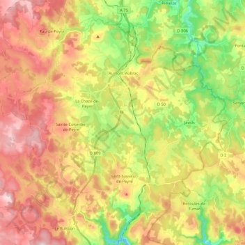
Peyre en Aubrac topographic map
Interactive map
Click on the map to display elevation.
About this map
Name: Peyre en Aubrac topographic map, elevation, terrain.
Average elevation: 1,073 m
Minimum elevation: 873 m
Maximum elevation: 1,277 m
Other topographic maps
Click on a map to view its topography, its elevation and its terrain.
Les Vanels
France > Occitania > Lozère > Vebron
Les Vanels, Vebron, Florac, Lozère, Occitania, Metropolitan France, 48400, France
Average elevation: 813 m
Salèles
France > Occitania > Lozère > Peyre en Aubrac
Salèles, Fau-de-Peyre, Peyre en Aubrac, Mende, Lozère, Occitania, Metropolitan France, 48130, France
Average elevation: 1,153 m
Saint-Étienne-Vallée-Française
Saint-Étienne-Vallée-Française, Florac, Lozère, Occitania, Metropolitan France, 48330, France
Average elevation: 477 m
Truc de Bringer
France > Occitania > Lozère > Saint-Chély-d'Apcher
Truc de Bringer, Saint-Chély-d'Apcher, Mende, Lozère, Occitania, Metropolitan France, 48200, France
Average elevation: 1,013 m
La Bastide
France > Occitania > Lozère > La Bastide-Puylaurent
La Bastide, La Bastide-Puylaurent, Mende, Lozère, Occitania, Metropolitan France, 48250, France
Average elevation: 1,084 m
Saint-Prejet
France > Occitania > Lozère > Massegros Causses Gorges
Saint-Prejet, Les Vignes, Massegros Causses Gorges, Florac, Lozère, Occitania, Metropolitan France, 48210, France
Average elevation: 788 m
Finiels
France > Occitania > Lozère > Pont de Montvert - Sud Mont Lozère
Finiels, Le Pont-de-Montvert, Pont de Montvert - Sud Mont Lozère, Florac, Lozère, Occitania, Metropolitan France, 48220, France
Average elevation: 1,362 m
Le Coustat
France > Occitania > Lozère > Nasbinals
Le Coustat, Nasbinals, Mende, Lozère, Occitania, Metropolitan France, 48260, France
Average elevation: 1,202 m
Lespartis
France > Occitania > Lozère > Peyre en Aubrac > Aumont-Aubrac
Lespartis, Aumont-Aubrac, Peyre en Aubrac, Mende, Lozère, Occitania, Metropolitan France, 48130, France
Average elevation: 1,047 m
Pont de Montvert - Sud Mont Lozère
Pont de Montvert - Sud Mont Lozère, Florac, Lozère, Occitania, Metropolitan France, 48220, France
Average elevation: 1,203 m
Biffares
France > Occitania > Lozère > Saint-Alban-sur-Limagnole
Biffares, Saint-Alban-sur-Limagnole, Mende, Lozère, Occitania, Metropolitan France, 48120, France
Average elevation: 983 m
Saint-Michel-de-Dèze
Saint-Michel-de-Dèze, Florac, Lozère, Occitania, Metropolitan France, 48160, France
Average elevation: 505 m
Saint-Alban-sur-Limagnole
Saint-Alban-sur-Limagnole, Mende, Lozère, Occitania, Metropolitan France, 48120, France
Average elevation: 1,051 m
Aumont-Aubrac
France > Occitania > Lozère > Peyre en Aubrac
Aumont-Aubrac, Peyre en Aubrac, Mende, Lozère, Occitania, Metropolitan France, 48130, France
Average elevation: 1,044 m
Fraissinet-de-Lozère
France > Occitania > Lozère > Pont de Montvert - Sud Mont Lozère
Fraissinet-de-Lozère, Pont de Montvert - Sud Mont Lozère, Florac, Lozère, Occitania, Metropolitan France, 48220, France
Average elevation: 1,226 m