
Thank you for supporting this site ❤️
Make a donation
Make a donation
Gear up for your next adventure:
As an Amazon Associate, this site earns from qualifying purchases at no extra cost to you.
Sechshelden topographic map
Click on the map to display elevation.
Thank you for supporting this site ❤️
Make a donation
Make a donation
Gear up for your next adventure:
As an Amazon Associate, this site earns from qualifying purchases at no extra cost to you.
About this map
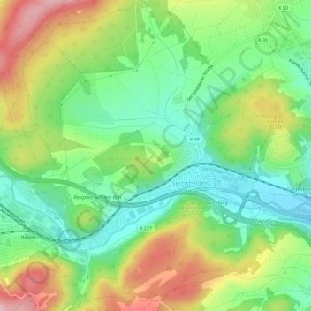
Name: Sechshelden topographic map, elevation, terrain.
Location: Sechshelden, Haiger, Lahn-Dill-Kreis, Hessen, Duitsland (50.73197 8.22046 50.76781 8.26660)
Average elevation: 304 m
Minimum elevation: 229 m
Maximum elevation: 428 m
Thank you for supporting this site ❤️
Make a donation
Make a donation
Gear up for your next adventure:
As an Amazon Associate, this site earns from qualifying purchases at no extra cost to you.