
Thank you for supporting this site ❤️
Make a donation
Make a donation
Gear up for your next adventure:
As an Amazon Associate, this site earns from qualifying purchases at no extra cost to you.
POBLAZON topographic map
Click on the map to display elevation.
Thank you for supporting this site ❤️
Make a donation
Make a donation
Gear up for your next adventure:
As an Amazon Associate, this site earns from qualifying purchases at no extra cost to you.
About this map
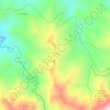
Name: POBLAZON topographic map, elevation, terrain.
Location: POBLAZON, Popayán, Centro, Cauca, Pacífica, Colombia (2.38520 -76.55822 2.40520 -76.53822)
Average elevation: 2,230 m
Minimum elevation: 2,066 m
Maximum elevation: 2,435 m
Thank you for supporting this site ❤️
Make a donation
Make a donation
Gear up for your next adventure:
As an Amazon Associate, this site earns from qualifying purchases at no extra cost to you.
Other topographic maps
Click on a map to view its topography, its elevation and its terrain.