
Jackson County topographic map
Interactive map
Click on the map to display elevation.
Jackson County
According to the US Census Bureau, the county has a total area of 602 square miles (1,560 km2), of which 584 square miles (1,510 km2) is land and 18 square miles (47 km2) (3.0%) is water. The average elevation is around 400 feet (120 m), except near the Mississippi River.
About this map
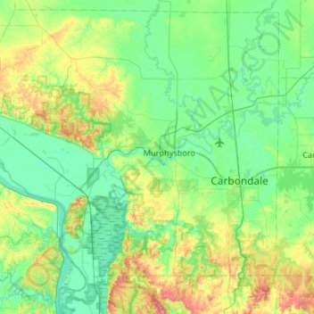
Name: Jackson County topographic map, elevation, terrain.
Location: Jackson County, Illinois, United States (37.56186 -89.67955 37.95520 -89.15062)
Average elevation: 143 m
Minimum elevation: 92 m
Maximum elevation: 314 m
Other topographic maps
Click on a map to view its topography, its elevation and its terrain.
Wood Oaks Green Park Sled Hill
United States > Illinois > Cook County > Northbrook
Average elevation: 202 m