
Thank you for supporting this site ❤️
Make a donation
Make a donation
Gear up for your next adventure:
As an Amazon Associate, this site earns from qualifying purchases at no extra cost to you.
Geo na h-Airde topographic map
Click on the map to display elevation.
Thank you for supporting this site ❤️
Make a donation
Make a donation
Gear up for your next adventure:
As an Amazon Associate, this site earns from qualifying purchases at no extra cost to you.
About this map
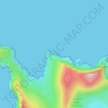
Name: Geo na h-Airde topographic map, elevation, terrain.
Location: Geo na h-Airde, Western Isles, Scotland, United Kingdom (57.81597 -8.60088 57.83597 -8.58088)
Average elevation: 65 m
Minimum elevation: 0 m
Maximum elevation: 425 m
Thank you for supporting this site ❤️
Make a donation
Make a donation
Gear up for your next adventure:
As an Amazon Associate, this site earns from qualifying purchases at no extra cost to you.
Other topographic maps
Click on a map to view its topography, its elevation and its terrain.