Geolocate

St. Charles topographic map

Click on the map to display elevation.

About this map
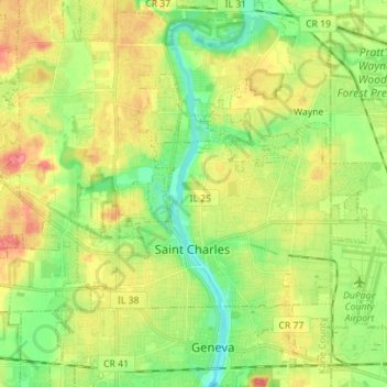
Name: St. Charles topographic map, elevation, terrain.

Location: St. Charles, Kane County, Illinois, United States (41.89702 -88.38960 41.96113 -88.24950)

Average elevation: 234 m

Minimum elevation: 204 m

Maximum elevation: 271 m

Gear up for your next adventure:

🎒Surveyor High-Vis Vests - Multi-pocket safety vests for field professionals
👣Waterproof Leg Gaiters - Keep bog water and debris out of your boots
🔌Fast Car Chargers - Recharge GPS and phones between trailheads
📊Altimeters & Barometers - Track elevation and weather changes
🍽️Camping Utensil Sets - Complete eating sets

As an Amazon Associate, this site earns from qualifying purchases at no extra cost to you.