Geolocate

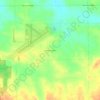
Freeport topographic map

Click on the map to display elevation.

About this map

Name: Freeport topographic map, elevation, terrain.

Location: Freeport, Stephenson County, Illinois, 61032, United States (42.24932 -89.68657 42.32140 -89.57764)

Average elevation: 244 m

Minimum elevation: 205 m

Maximum elevation: 275 m

Other topographic maps

Click on a map to view its topography, its elevation and its terrain.
Gear up for your next adventure:

🧯Compact Fire Extinguishers - Safety for campervans and expedition vehicles
🧿Weather Radios - Track weather in remote places
📈Fitness Trackers - Monitor activity and hike metrics
📊Altimeters & Barometers - Track elevation and weather changes
🎒Backpack Rain Covers - Extra protection for non-waterproof rucksacks

As an Amazon Associate, this site earns from qualifying purchases at no extra cost to you.