
Make a donation
Gear up for your next adventure:
As an Amazon Associate, this site earns from qualifying purchases at no extra cost to you.
Céret topographic map
Click on the map to display elevation.
Make a donation
Gear up for your next adventure:
As an Amazon Associate, this site earns from qualifying purchases at no extra cost to you.
Céret
The town lies in the foothills of the Pyrénées mountains, in southern France, on the river Tech at an altitude of 175–1400 meters. It is 7 km (4.3 mi) from the Autoroute A9, 200 km (120 mi) from Montpellier, 250 km (160 mi) from Toulouse and 180 km (110 mi) from Barcelona. The GR 10 footpath runs close by.
Make a donation
Gear up for your next adventure:
As an Amazon Associate, this site earns from qualifying purchases at no extra cost to you.
About this map
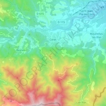
Name: Céret topographic map, elevation, terrain.
Average elevation: 454 m
Minimum elevation: 74 m
Maximum elevation: 1,431 m
Make a donation
Gear up for your next adventure:
As an Amazon Associate, this site earns from qualifying purchases at no extra cost to you.